ROVANIEMI (FIN)
GENERAL INFORMATIONS
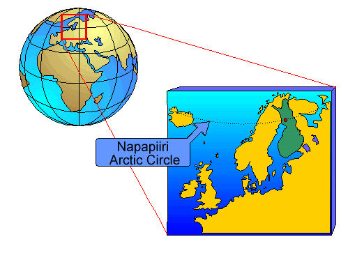
Rovaniemi is the capital of Lapland and also called the arctic town. In fact it is located on the arctic circle (66° 33' 07''N 25° 50' 51''E), more precisely 835 km North from Helsinki and 2500 km South from the North Pole.
STATISTICAL DATA
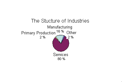
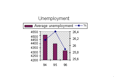
ECONOMY
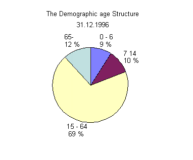
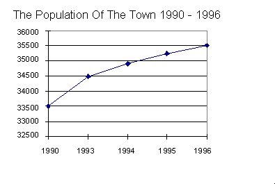
DEMOGRAPHY
CLIMATE
Within the years 1931-1990:
average temperature +0.2 °C
snow-cover: annual average 183 days
minimum temperature recorded -45.3 °C (1946), maximum +30.6 °C (1972).
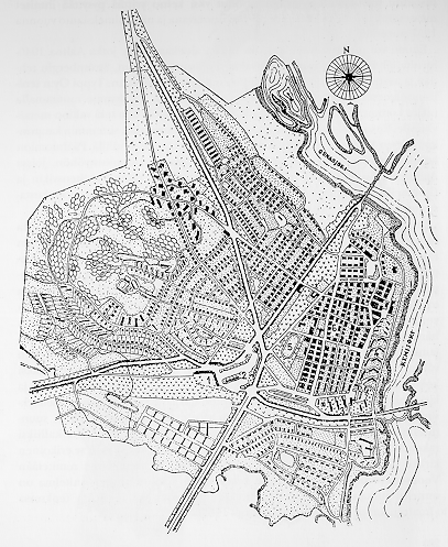
Rovaniemi, founded in 1829, was totally destroyed in 1944 by retiring German troups. It was then rebuilt according to Alvar Aalto's town-plan. It is possible to see on the map: the railway station (1), the traffic joint(2), the administration centre(3), the public employees' houses(4), the sport field (5) and theold, destroyed town(6). Within the project, the suburban houses are an outstanding element: their location in esagonal-shaped lots, in fact, allows several choices in the combination of the buildings.
Rovaniemi's identity
Go to index